News
Ukraine Crisis Latest Activation for Johns Hopkins APL’s Disaster Response Corps
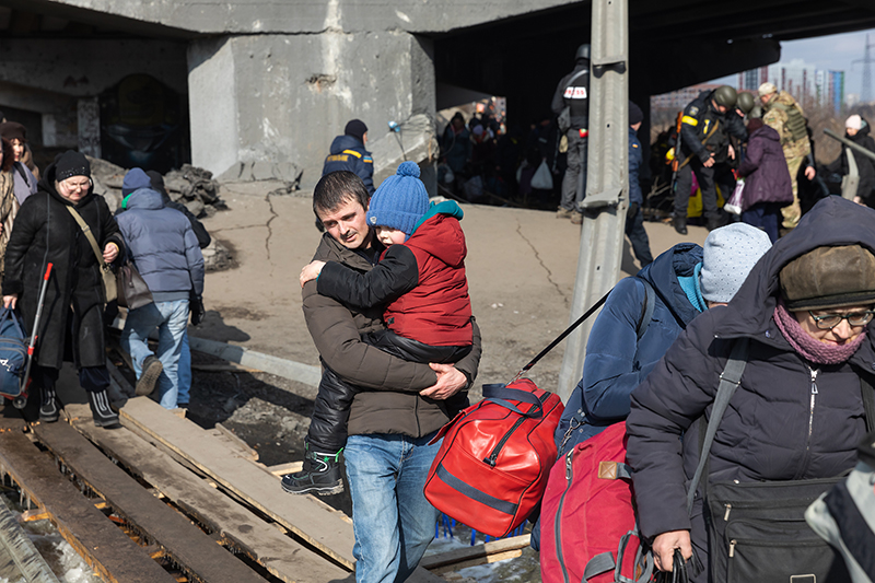
Residents of Irpin, Ukraine, evacuate the city amid Russian attack in March 2022
Credit: Bigstock/Mikhail Palinchak
With natural disasters occurring with increasing frequency, and violent conflict remaining an ever-present reality, creating capabilities to accurately assess these emergent situations is more important than ever. For the past three years, the Johns Hopkins Applied Physics Laboratory (APL) in Laurel, Maryland, has been bringing its world-class expertise in data analytics, remote sensing, systems engineering and other relevant disciplines to bear in a new way through the Disaster Response Corps, building on decades of experience making critical contributions to critical challenges.
“Disasters are increasing in both frequency and severity, but what’s often not appreciated is that they’re also increasingly unpredictable,” said Jeff Freeman, who leads the Disaster Response Corps, and previously worked for the Centers for Disease Control and Prevention (CDC), where he was involved in standing up the Center for Humanitarian Emergencies. “COVID-19 has been a perfect illustration of that fact, but the same is true of the behavior of natural disasters — to name just one example, there’s not a weather model in existence that would have predicted that Hurricane Harvey, back in 2017, would just stop over Houston, not move, and dump rain for days on end.”
Compounding that unpredictability is the fact that legacy systems for acquiring and analyzing information during disasters are largely antiquated, he added.
“When disaster strikes, people fall back on what they know and trust — and what they know and trust is frequently outdated,” Freeman said. “As a result, there’s a major gap between the research community and the response community. That’s where the Response Corps comes in.”
Early Activations: Making Crucial Connections
The Disaster Response Corps was first activated in the summer of 2019, during the Ebola outbreak in the Democratic Republic of the Congo — the second largest in history. Ebola is a devastating but relatively slow-moving virus, which makes contact tracing a key component to containing its spread. APL software engineers assisted the U.S. government by improving upon an existing, but limited, software application to enable first responders to visualize chains of Ebola transmission.
The app helped responders confirm that a leading cause of new cases in the country was health care-associated infections, when patients admitted to the hospital for unrelated reasons contracted Ebola. Within a week of the app going live, it had been incorporated into field trainings in Congo. The tool is now being adopted for use in responding to the monkeypox outbreak.
Subsequent Response Corps activations have occurred in response to Hurricane Dorian in the Bahamas in 2019, the earthquake in Puerto Rico in 2020, the earthquake in Haiti in 2021, the tornado outbreak in the United States in 2021, the COVID-19 pandemic and, most recently, the war in Ukraine.
COVID-19 Response
The Johns Hopkins University (JHU) COVID-19 open data pipeline supports the globally trusted COVID-19 tracking dashboard and the Johns Hopkins Coronavirus Research Center — to this day one of the most referenced up-to-date, authoritative sources of information on the pandemic. This work provided the technological foundation for other case and death count data that informs modeling and analysis efforts for the federal pandemic response.
As has been documented, creating the open data pipeline was a gargantuan effort on the part of many people across APL — a 24/7 commitment that stretched across the better part of a year, according to Aaron Katz, who led the effort — but it began with the Disaster Response Corps.
“If you look at the history of APL — the development of the proximity fuze, of Transit, of all these historic accomplishments that live in the lore of the Lab — they’re all stories of scientists and engineers who saw an urgent problem and almost willed their way to an answer,” said Katz, who spent several years working on other APL disease surveillance efforts before getting involved with the Response Corps. “That’s why the Lab exists to begin with — we’re here when the country needs us. The Response Corps has given us a vehicle to bring APL’s expertise to bear in a wider variety of emergency situations.”
Puerto Rico and Haiti Earthquake Response
Many of the Response Corps’ activations — including in response to the earthquakes in Puerto Rico and Haiti, recent U.S. tornadoes and the war in Ukraine — have relied on APL’s remote sensing expertise. The Puerto Rico and Haiti earthquakes required the Response Corps to apply and extend APL-developed systems such as Humanitarian Assistance and Disaster Relief (HADR) and Cobalt for analyzing satellite imagery and other publicly available information, such as photos and video from social media and news media, to help government and response teams locate displacement camps and determine their size.
These efforts take place on much shorter timelines than APL’s more traditional engagements, which makes them more challenging in many ways — but more rewarding in others, said Marc Kolodner, a remote sensing scientist who led the Puerto Rico, Haiti and 2021 Mayfield, Kentucky, tornado response efforts for the Response Corps.
“With a lot of our work, it can be years before you see the benefits, so to be able to very quickly leverage our analytical capabilities, run our models against the data and provide results in a very timely and impactful way is a great opportunity and something we haven’t traditionally been able to do at APL,” Kolodner said. “Sometimes [Freeman] will email us on a weekend, and we drop what we’re doing, and by Monday morning we deliver whatever’s needed.”
The challenge of quickly adapting and applying existing capabilities in new scenarios has pushed APL’s scientists and engineers to improve those capabilities for future use, Kolodner added.
“What works in one region or scenario doesn’t necessarily work elsewhere, but the more we apply and adapt our capabilities, the better they become,” he said. “We try to develop the tools along the way so that next time we’re able to do the work more quickly and efficiently.”
Kolodner and his team were able to achieve much of the data analysis that was performed manually in support of the Puerto Rico earthquake response, but in a more automated manner during the Haiti earthquake response. For the Haiti response, they were also able to incorporate data from synthetic aperture radar (SAR), an imaging modality that is not affected by weather, into their data pipeline. Both of these improvements have proven to be crucial to the Response Corps’ ongoing Ukraine efforts.
Ukraine: Assessing Medical Infrastructure
In March, shortly after Russia invaded Ukraine, the U.S. government engaged the Corps to assess the condition of Ukraine’s medical infrastructure.
“If and when the international community is able to enter the country, it will be vital to know the state of medical facilities, which ones are usable and which aren’t,” said Joshua Broadwater, a remote-sensing scientist who, along with data scientist Beatrice Garcia, co-leads APL’s Ukraine work. “We’re creating that capability now so that the response community will be able to make informed decisions about logistics and personnel deployment when the time comes to rebuild.”
In a matter of weeks, the APL team had adapted existing pipelines for collecting and verifying a wide variety of relevant data, including open-source and publicly available information as well as overhead and SAR imagery, and was producing weekly reports on the status of medical infrastructure in Ukraine.
“Within a week of getting to work, we’d set up the pipeline for one city,” Broadwater said. “And then we did the same for five or six cities, adding a city roughly every week, and producing reports on every city each week.”
The systems integration effort is the most ambitious project yet undertaken by the Response Corps. Garcia, who led the original development of HADR to identify building damage from flooding, hurricanes and tornados in the United States, led the way in adapting the tool to detect damage caused by explosive weaponry in Eastern Europe. Incorporating SAR was also a key strategy to overcome the limitations of cloud cover. The team is manually adding input from social media and news media data pipelines to validate their information in order to ensure the highest possible level of accuracy.
“Our ultimate goal is to create a completely integrated and automated capability that is data-agnostic — one that can take in satellite imagery, overhead imagery, SAR, images from social media and news media and even video,” Garcia said. “It’s going to take a lot of effort, but one of the biggest lessons I’ve learned from working on this project is that we have a lot of capabilities and expertise at the Lab — whether that’s in artificial intelligence, remote sensing or even Russian linguistics. If you need something, chances are someone is probably already working on it or has subject-matter expertise to bring to the table.”