News

Sensing the Planet: Johns Hopkins APL Working to Provide Data for Mitigating Climate Change

Mon, 09/20/2021 - 16:27
Paulette Campbell

Researchers at the Johns Hopkins Applied Physics Laboratory (APL) in Laurel, Maryland, are applying expertise in sensing and modeling to predict Earth system changes, providing data to support decisions on the national security aspects of mitigating effects of climate change.

“We need continuous, ubiquitous sensing to understand current states and predict future changes of Earth’s systems,” said Bobby Armiger, a branch supervisor in APL’s Research and Exploratory Development Department (REDD) who, along with colleague Marisa Hughes, leads a program to explore the impact of climate change on our world and national security. “The work we are doing in sensing and modeling will provide next-generation data critical to mitigating climate change and its effects.”

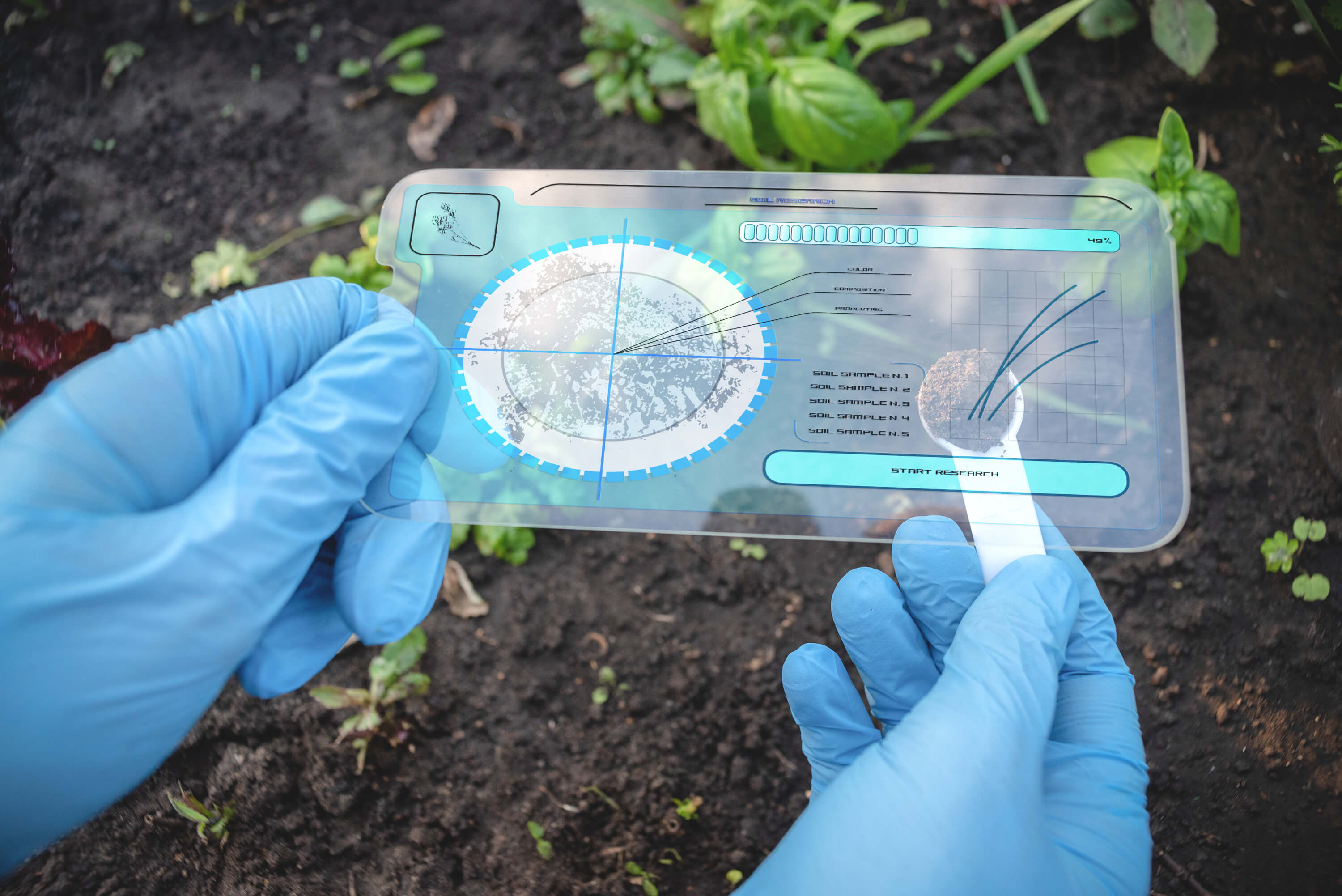
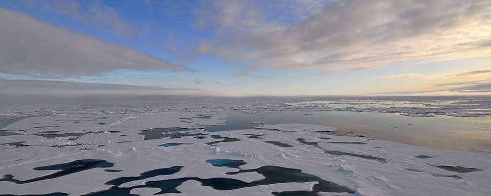
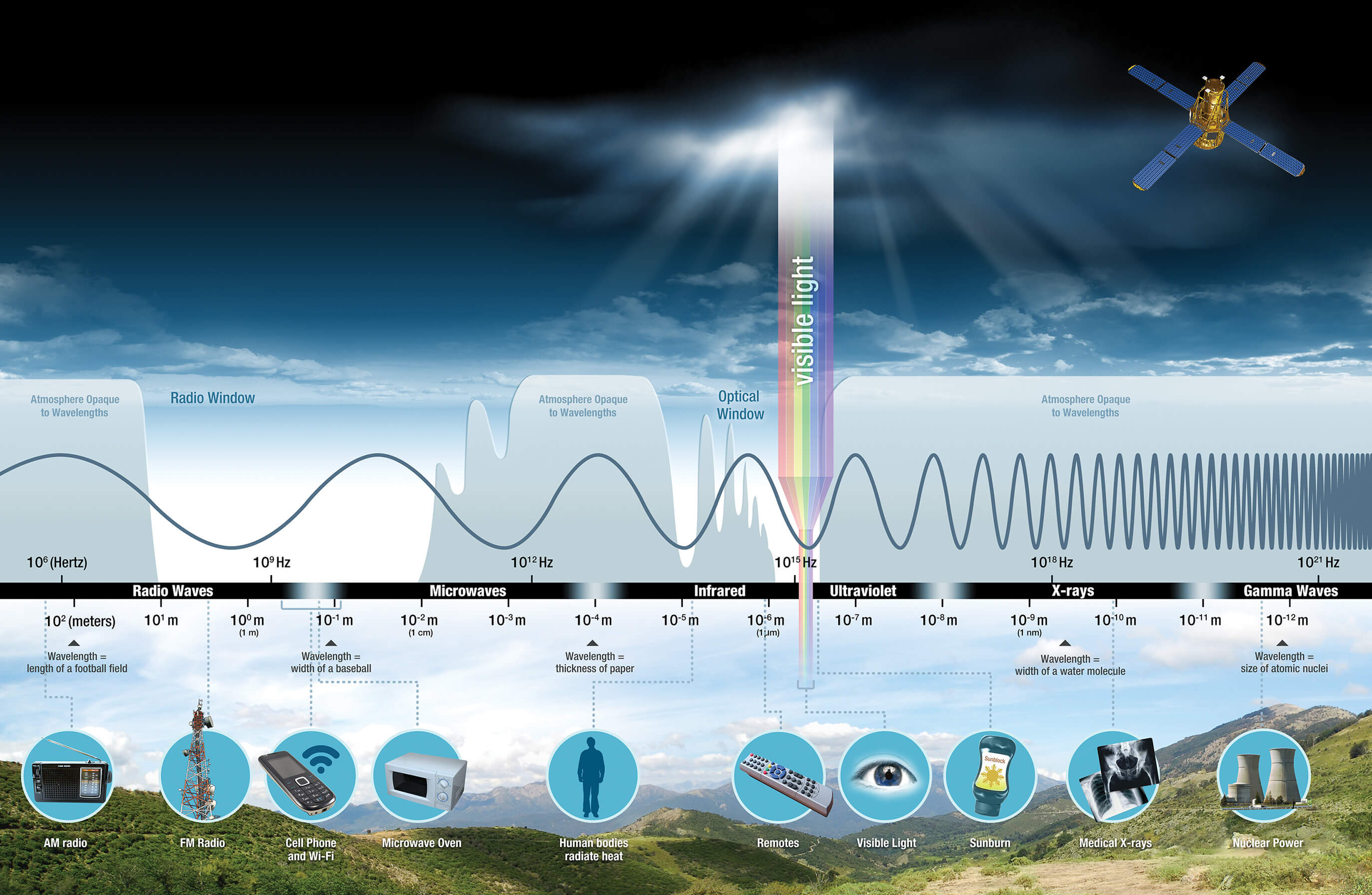
From developing new ways to monitor emissions, soil moisture and arctic ice, to identifying the effect that climate change may have on military sensors, below is a snapshot of the Laboratory’s work in this area.

“These projects represent a small subset of the work we are doing to better understand Earth as a system, and to make sustainable contributions that address national security and global challenges resulting from climate change,” said Hughes, the assistant program manager for Environmental Resilience. “Novel technological advances will be needed to combat climate change, and APL has a proven history of generating the type of breakthroughs that will be needed, ranging from fundamental scientific discoveries, to operational capabilities, to strategic policy analyses.”

Measuring Greenhouse Emissions
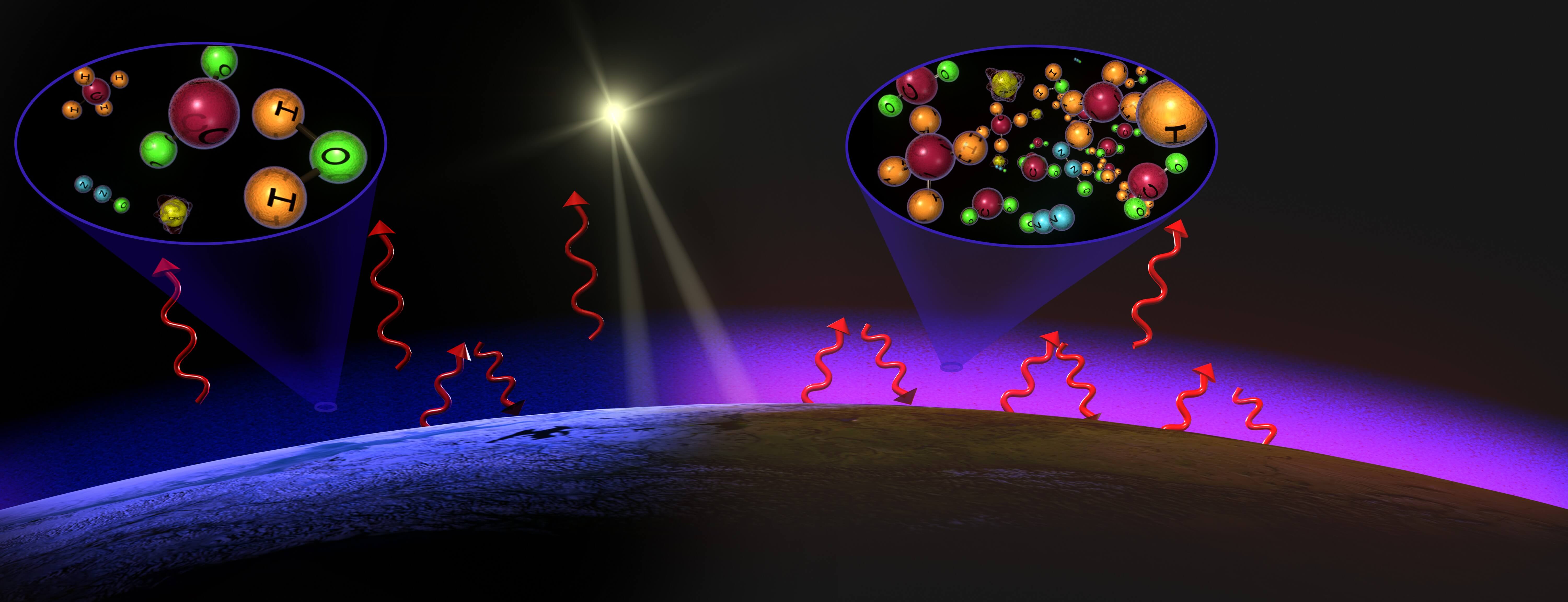
Greenhouse gas emissions from human activities are among the most significant driver of observed climate change. The international community is moving toward agreements to work together to limit such emissions — but these agreements require all nations to accurately measure and monitor changes over time.

“Current approaches for estimating greenhouse gas leverage either space-based or ground-based measurements,” explained Ryan Mukherjee, a computer vision researcher in REDD. “While these approaches can be highly accurate, they have deficiencies in spatial resolution, spatial coverage and/or temporal resolution. These deficiencies cause significant challenges when using greenhouse gas estimates to monitor and reduce global emissions because they lead to less actionable estimates.”

Mukherjee is leading a team exploring a novel approach to measuring greenhouse gas: using artificial intelligence (AI) and machine learning, even though they are not traditionally used for greenhouse gas estimation, to better utilize data already being collected by existing platforms.

“We want to use AI to repurpose existing high-resolution visible-spectrum satellites for estimating greenhouse gas emissions, as these systems can help address the current deficiencies and enable us to pinpoint emissions,” he explained. “Researchers recently demonstrated success estimating atmospheric particulate matter using visible-spectrum imagery, which leads us to believe that greenhouse gas estimation may also be possible.”

If successful, their work could enable more actionable insights and rapid response to curb emissions globally by leveraging data from the large number of visible-spectrum satellites currently in operation. Such insights will be critical for many international and domestic climate activities and products.

Monitoring Soil From Space

Floods, drought, landslides and fires — all common examples of a changing climate — occur when weather events meet soil that is either too wet or too dry. “Yet farmers still rely on poking rods into the ground to see how wet or dry a field is,” observed Mary Keller, a remote sensing expert in APL’s Space Exploration Sector.

APL researchers have been working on remote sensing solutions for the Earth, Moon and Mars. “But, on Earth, ionospheric interference introduces noise and distorts the desired signals,” Keller explained. “We are developing a model to characterize ionospheric effects on radio frequency [RF] signals to improve sensing of wet and frozen soils.”

Radio waves are modified by the material properties they encounter as they pass through the Earth. The thought from APL researchers is, if RF energy is sent in at different angles, the emerging energy will spread across a range of angles as a function of subsurface material properties. If different polarizations at the same frequency are passed through the subsurface, the polarizations change as well. As such, for the past three years, Laboratory scientists have been developing reflectometers to track soil moisture that are designed to ride along on communications network satellites.

“For the Moon and Mars — airless, but soil-covered rocky bodies with frozen or, perhaps, liquid water in the subsurface — that approach is good enough,” Keller explained. “For Earth, there is an additional wrinkle. Radio signals transmitted toward Earth from space pass through the ionosphere, which induces time- and space-dependent changes in the relative magnitudes of the transmitted polarizations, the signal our system uses to get to soil moisture content. Adding ionospheric effects into our model will allow for Earth applications.”

Once implemented, this technology has implications for identifying soil moisture changes due to climate change, as well as for identifying stable areas for launching rescue missions in disaster recovery operations.

Arctic Sea Ice Modeling and Prediction

The Arctic region has been dramatically affected by changes in Earth’s climate. In the Arctic Ocean, sea ice extent — the area of ocean with at least 15% sea ice concentration — typically reaches its maximum in March and its minimum in September. However, in recent years, Arctic sea ice extent has steadily decreased in all months, and the 5% that lasts year-round is thinner and more fragile.

Nonetheless, with sea ice retreat opening large areas of the Arctic, government and commercial maritime activity has increased, meaning weekly and monthly forecasts are needed so ships can proceed safely.

“Ships in transit in the Arctic basin need to know several days to a week in advance where ice will be and in what state to chart courses and plan for supplies and harborage,” explained Christine Piatko, a computer science researcher in REDD. “But the short-term sea ice forecasts used by civilian and military fleets for navigation in the opening Arctic are at present ad hoc, inconsistent and generally dependent on continuity from current conditions and forecaster intuition, much as conventional weather forecasts were 30 or 40 years ago.”

Piatko and Keller are developing advanced models of Arctic conditions and Arctic access at high spatial and temporal resolutions to dramatically improve short-term sea ice forecasting. These models will use unique APL detection methods as well as deep learning methods to provide accurate and timely results by fusing data across multimodal satellite imagery and weather information.

“These machine learning techniques provide the potential to rapidly assimilate and analyze multiple imagery sources, along with weather model data, to provide more timely forecasts,” Piatko said.

Influencing Sensor Designs

Recent changes to Earth’s climate include phenomena that impact the transmission of RF, infrared (IR) and electro-optical (EO) signals. According to Jonathan Gehman of APL’s Air and Missile Defense Sector, expected trends in many of these bands appear to be toward less visibility. However, researchers do not yet know the impact of these effects, either in isolation or in combination.

“Some of today’s sensing systems were designed 50 years ago,” noted Gehman, an expert in physics-based modeling of electromagnetic wave propagation and scattering. “The sensor designs being developed in 2021 should be robust enough to endure conditions 50‑plus years from now. The challenge is to find out what the future climate might look like from an RF, IR and EO visibility standpoint so that designs in 2021 anticipate the 2071 environment.”

Gehman and his research team have homed in on what they suspect are the effects most likely to impact sensor performance. They are exploring the impact of increased moisture content on RF; increased temperature, carbon dioxide and moisture on IR visibility; increased temperature and moisture on the efficacy of high-energy lasers; and increasing sea surface temperature on RF evaporation ducts.

“We plan to develop a simple mathematical model of the order-of-magnitude impact each factor has on sensor performance. Then we will quantify that impact and put the result in operational context,” Gehman explained. “An analysis like this has not yet been done. Having these answers will influence future sensor design and identify emerging limitations of current systems.”